CHC's regional scientist Alkhalil Adoum publishes "An Evaluation of 20-m ESA-CCI S2 Prototype LC Product" with Frontiers in Sustainable Food Systems.
Abstract:
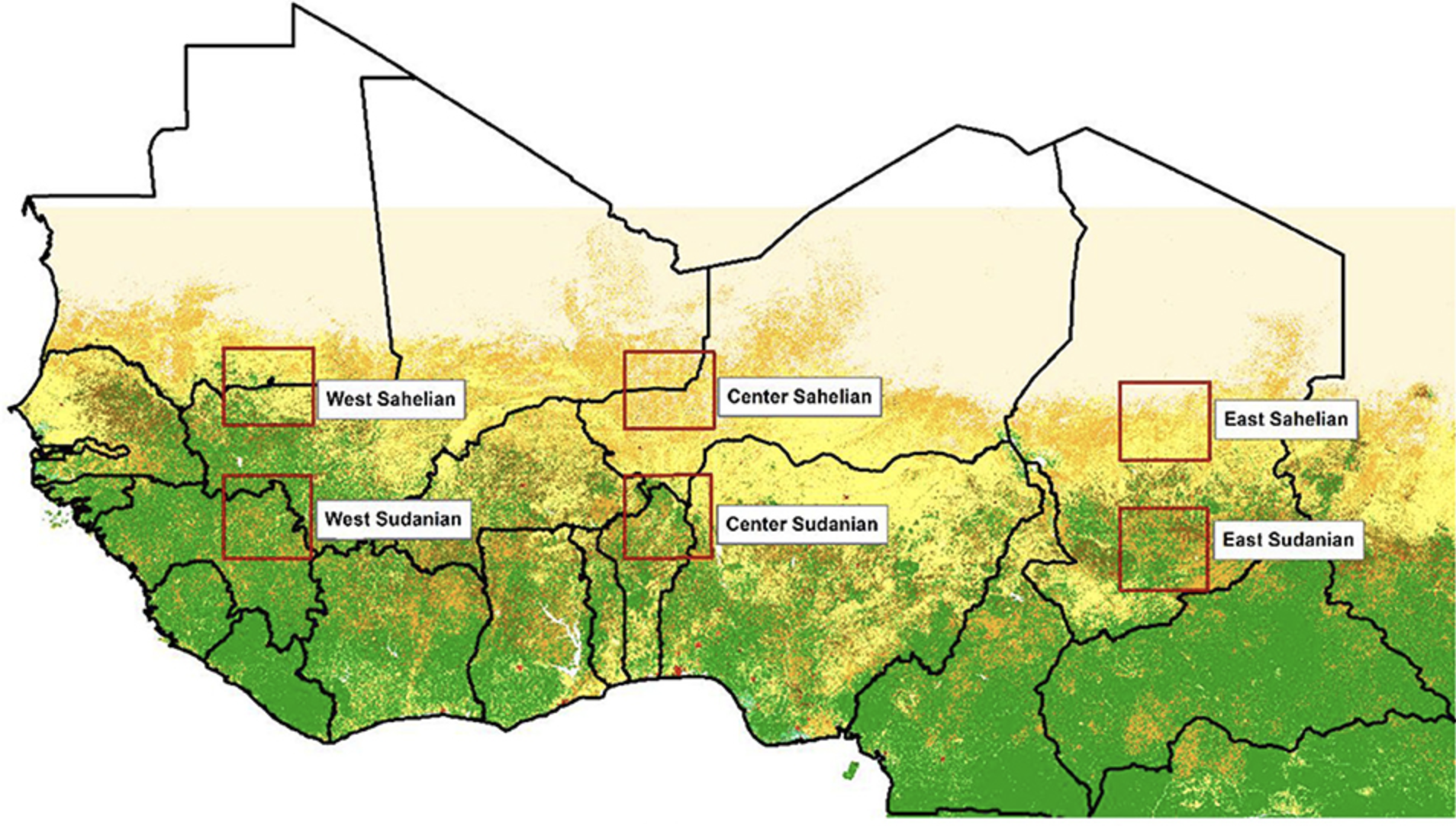
Agricultural production estimate represents a key element in food security analysis, but before the agricultural statistics services process and release the data some precious early warning time is lost. While many remote sensing derived yield estimation methods are used operationally we're still in search of a robust remote sensing based cropped area estimate. ESA-CCI (European Space Agency–Climate Change Initiative) released in late 2016 the S2 prototype Land Cover map at 20 m for Africa the first high resolution product of its kind. The objective of the current study is to evaluate how well the 20-m ESA-CCI S2 prototype LC represents cropland; in case the results turn out satisfactory the cropland class could be used as a crop mask that could be used along with yield estimate to assess crop production. The assessment method consisted of (1) selecting six equal size polygons so that the Sahelian and Sudanian zones of West Africa are represented at each of the three basins of the Sahel (Western, Central and Eastern), (2) generating four hundred dots randomly overlaid on the sample polygon (3) using Sentinel 2A 10 m or Google Earth images as ground truth. A dot count is then obtained for each one of the map being assessed and the reference. The process is repeated 10 times bringing the total number of dots used to four thousand for each of the 6 sample polygons. The number of classes is reduced to two (cropland and other). Binary confusion matrices are build and the accuracy, the precision and the sensitivity or recall calculated. Since our main goal is to see how good the classification of cropland is, the analysis focuses on the precision and the recall. Values for both indicators are almost similar for the Sudanian zone, but significantly different for the Sahelian zone, where the higher values of the recall are not an indication of cropland classification performance but rather the result of the relatively small proportion of the actual cropland dots. Therefore, the precision remains here the privileged cropland classification performance indicator. Analysis of the precision indicates that the S2 prototype LC cropland in the Sahelian zone is <3% correct in East Sahel, <7% in West Sahel and about a third of the time correct for the Center Sahelian. This is easily explained by the fact that the S2 prototype LC has mistaken the sand dunes and degraded land that makes up a significant part of the cropland. Even in the Sudanian zone where the analysis shows a better cropland classification performance, the highest precision indicates that the cropland classification is incorrect for a little over 28% of cases. Therefore, the ESA-CCI S2 prototype land cover map can't be used as a crop mask.
The full paper can be found here.