Data Overview
The Climate Hazards Global Precipitation with Stations (CHGPS) is a high resolution gauge-based gridded monthly precipitation dataset spanning 1900 to the previous month. The CHGPS combines the excellent GPCC ‘Full’ precipitation dataset with additional station data drawn from the routinely updated and curated CHC station archive. The current CHGPS uses the GPCC Full 2022 product (Ziese et al. 2022). While of excellent quality, the GPCC Full product has experienced a substantial decline in the number of stations that it incorporates. The number of stations in the GPCC Full product, which ends in 2021, can be seen in Figure 1. Also shown in this time series plot is the number of unique CHC stations.
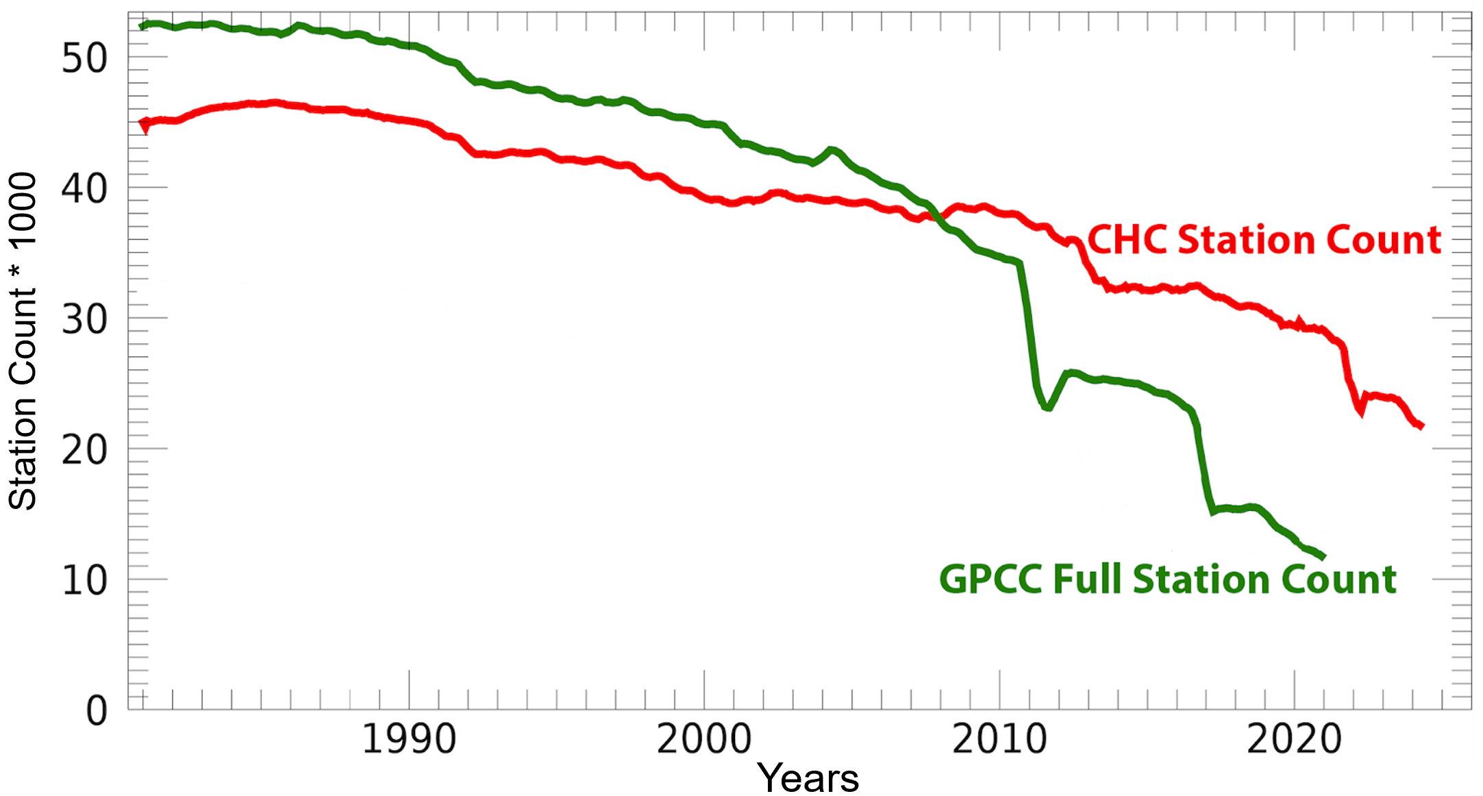
Figure 1.The number of unique monthly station observations in the GPCC Full and CHC precipitation observation archive.
Beginning around 2011, the CHC archive has substantially more observations. Thus combining information from both sources results in better data coverage. In addition, since the CHC data curation process happens quickly, a new monthly CHGPS field can be produced with a latency of just 15 to 20 days. High quality interpolated gauge estimates for last month can be accessed in the middle of the current month. These fields make use of two satellite-enhanced climatologies: the Climate Hazards Center Precipitation Climatology version 1 (CHPclimv1) and version 2 (CHPclimv2). These climatologies are described in Funk et al. 2015 and Funk et al. 2021. Combining stations with CHPclimv2 results in gauge undercatch corrected precipitation estimates. Combinations with CHPclimv1 provides users with non-gauge undercatch corrected values. These data are made available at resolutions of 0.05° and 0.25°. CHGPS provides one of the longest, timeliest and most complete global gauge-based precipitation records.
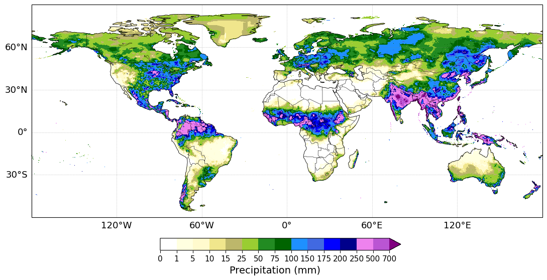
Figure 2. CHGPS monthly rainfall accumulation, July 2025
Data Access and Formats
CHGPS data can be downloaded as monthly GeoTIFF files from the CHC data repository at (0.05°) https://data.chc.ucsb.edu/experimental/CHGPS/v1/monthly_p05/ and (0.25°) https://data.chc.ucsb.edu/experimental/CHGPS/v1/monthly_p25/ resolution.
Additional resources include GPCC, CHC, and combined (GPCC and CHC) station density maps. These maps show the number of stations per grid, allowing users to evaluate the spatial distribution of gauge observations contributing to the dataset. GeoTifs showing the differences between the GPCC and CHC precipitation fields are also available.
See https://data.chc.ucsb.edu/experimental/CHGPS/v1/station_density_p25/ and https://data.chc.ucsb.edu/experimental/CHGPS/v1/differences/.
Data Production
Great care has been taken to ensure that the CHC grids align well with the GPCC archive. This involves i) statistical bias adjustments to align the CHC and GPCC means, ii) extensive efforts to incorporate similar station inputs in the CHC and GPCC data sets, and iii) the inclusion of many (~82,000) GPCC gauge undercatch-corrected station normal in the CHPclimv2 climatology. These efforts ensure that the CHC interpolated station data is as ‘interoperable’ as possible with the GPCC Full product. The interpolated CHC fields are then used to provide routinely rapidly updated values for the period following the end of the GPCC Full record. We refer to the resulting data stream as the CHGPS v1. New CHGPS versions will be released when there are new versions of the GPCC Full product.
Data Application
The CHGPS dataset, spanning more than a century, provides a valuable resource for analyzing rainfall trends, variability, and long-term patterns. It offers a robust climatological baseline that helps calculate anomalies and assess deviations from historical means. These precipitation anomalies help us quantify the severity of extreme rainfall events, placing floods and droughts in a historical context. This dataset also serves as a critical benchmark for validating climate and hydrological models.
Citations
Funk C., Verdin A., Michaelsen J., Peterson P., Pedreros D., Husak G. (2015). A Global Satellite Assisted Precipitation Climatology, Earth System Science Data, Earth Syst. Sci. Data Discuss. 7, 1-13, doi:10.5194/essdd-7-1-2015. https://essd.copernicus.org/articles/7/275/2015/essd-7-275-2015.html
Funk et al. (2021). Introducing and evaluating CHIMES - Timely station-enhanced Integrated Multi-satellitE Retrievals for Global Precipitation Measurement, Bulletin of the American Meteorological Society, 103 (2), E429-E454. https://journals.ametsoc.org/view/journals/bams/103/2/BAMS-D-20-0245.1.x...
Ziese, Markus; Rauthe-Schöch, Armin; Becker, Andreas; Finger, Peter; Rustemeier, Elke; Hänsel, Stephanie; Schneider, Udo (2022): GPCC Full Data Daily Version 2022 at 1.0°: Daily Land-Surface Precipitation from Rain-Gauges built on GTS-based and Historic Data. DOI: 10.5676/DWD_GPCC/FD_D_V2022_100